

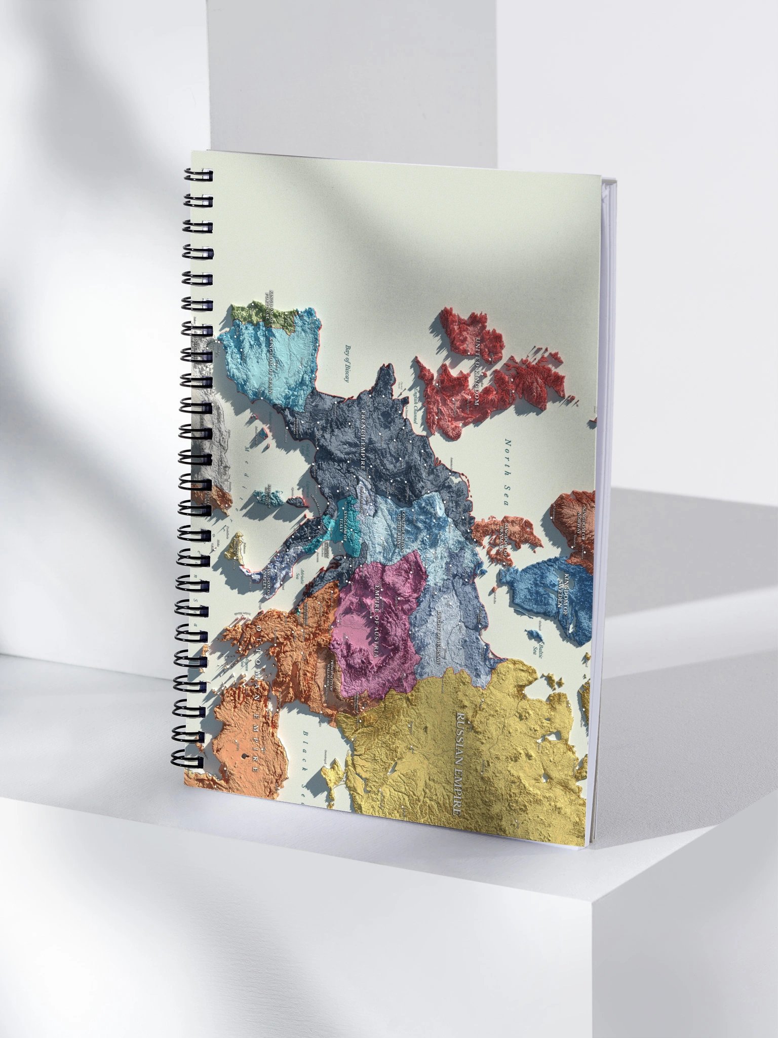
Napoleonic Europe - 1812 - Spiral Journal
Free shipping when you spend R$258.94+ for everyone. Promotion auto-applied on checkout.
Own Napoleonic Europe as it stood in 1812. Every frontier, river line, and empire boundary was rebuilt from period accurate maps to capture the continent at Napoleon’s peak.
And now you can plan your own campaigns, write your own orders, and redraw your own borders without anyone marching into your notebook.
More details
- Covers with soft-touch coating
- Metal wire-o binding
- 140 dotted pages
- US Size: 5.5″ × 8.5″ (13 × 21 cm)
- EU Size: 5.7″ × 8.5″ (14.5 × 21 cm)
- Cover weight: 10.38 oz/yd² (352 g/m²)
- Cover thickness: 0.375″ (0.95 cm)
- Page weight: 2.62 oz/yd² (89 g/m²)
EU GPSR Product Information:
- Manufacturer contact information
- Name: Knowledgia | Historical Maps, Prints and Digital Downloads
- Email: contact@support.knowledgia.co
- Postal address: PO Box 5696 Santa Monica, CA 90405
- Additional information:This product is made for adults. 2 year warranty in EEA and UK, established by Directive 1999/44/EC.
Size & Fit
- US Size: 5.5″ × 8.5″ (13 × 21 cm)
- EU Size: 5.7″ × 8.5″ (14.5 × 21 cm)
Quality Guarantee & Returns
- Quality is guaranteed. If there is a print error or visible quality issue, we'll replace or refund it.
- Because the products are made to order, we do not accept general returns or sizing-related returns.