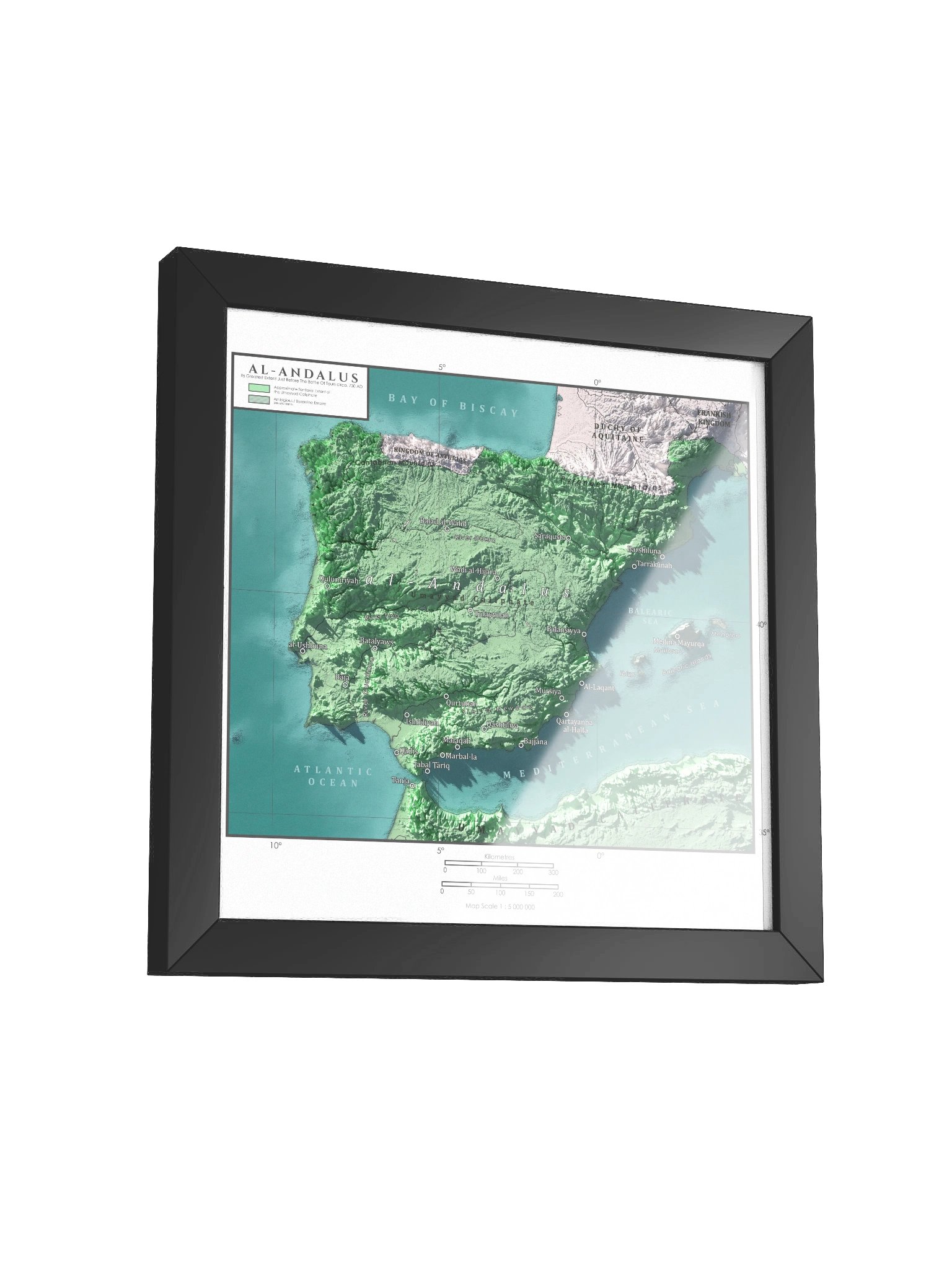

AL-Andalus | Muslim Iberia | 719 CE
This map captures Al-Andalus at its greatest early extension around 719 CE, when Muslim rule stretched across most of the Iberian Peninsula and reached beyond the Pyrenees into southern Gaul. Every frontier, coastline, major river, and key region was carefully reconstructed from historical sources to show one of the most dramatic transformations in medieval European history.
Printed at 10k+ resolution on premium matte paper and framed, this isn’t a generic wall map. It’s a statement piece built to last for decades, with sharp detail and a clean historical look from day one.
Hang it in your office, study, or living room. Gift it to the history lover fascinated by medieval Spain, Islamic history, or the rise of Al-Andalus. Put it in a classroom where it can spark real questions about conquest, culture, religion, and power.
This is the history of Al-Andalus you can own and pass down.
What you get:
Ultra-high-resolution archival print
Premium matte paper with rich, accurate detail
Solid frame, ready to hang
Carefully researched historical recreation of Al-Andalus at its greatest early extension, around 719 CE
This map is for personal use only.
More details
- Alder, semi-hardwood frame from renewable forests
- 75" (1.9 cm) thick frame
- Acrylite front protector
- Due to local wood import regulations, framed posters cannot be shipped to Australia.
EU GPSR Product Information:
- Manufacturer contact information
- Name: Knowledgia | Historical Maps, Prints and Digital Downloads
- Email: contact@support.knowledgia.co
- Postal address: PO Box 5696 Santa Monica, CA 90405
- Additional information: This product is made for adults. Meets the lead level requirements. 2 year warranty in EEA and UK
Size & Fit
Quality Guarantee & Returns
- Quality is guaranteed. If there is a print error or visible quality issue, we'll replace or refund it.
- Because the products are made to order, we do not accept general returns or sizing-related returns.