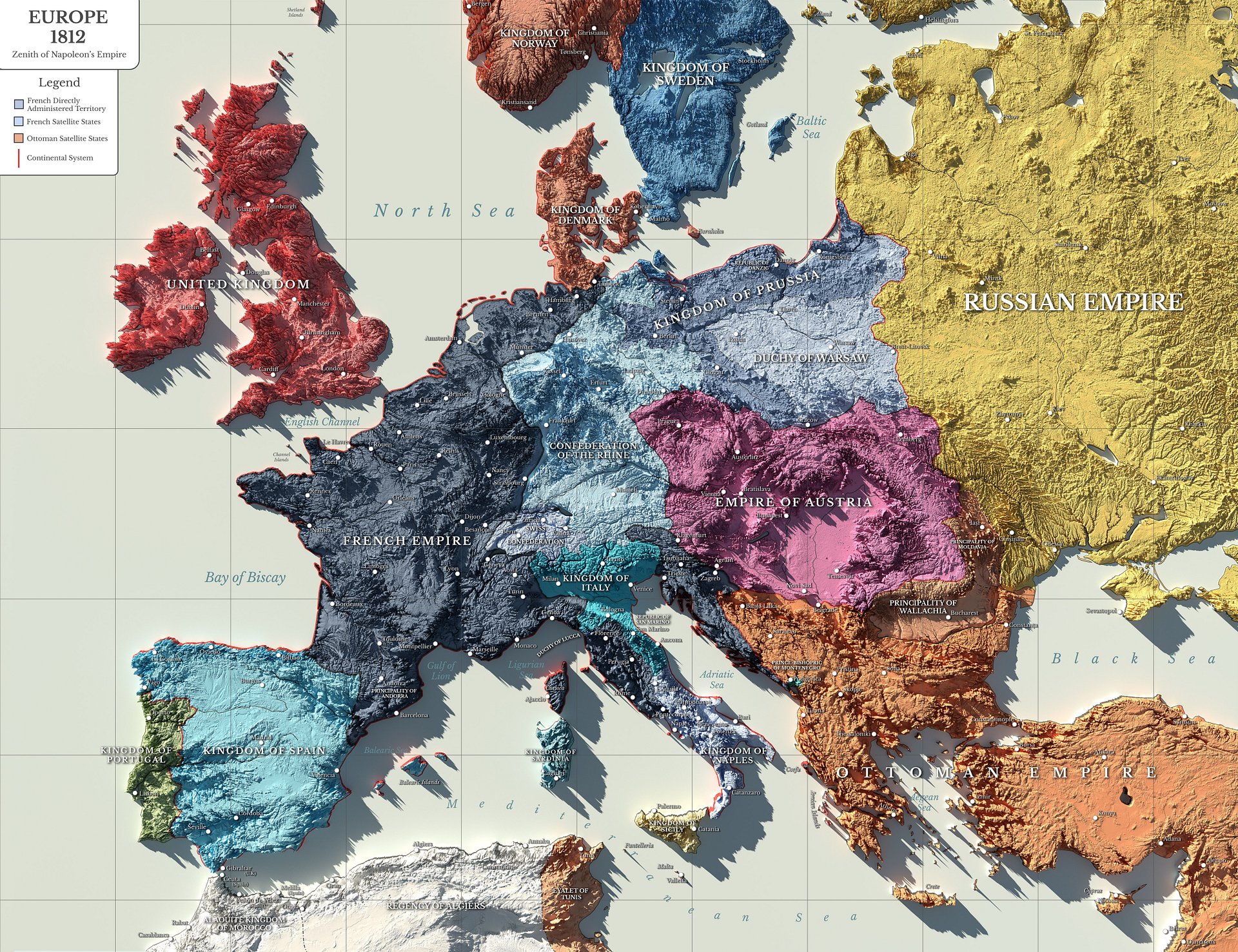
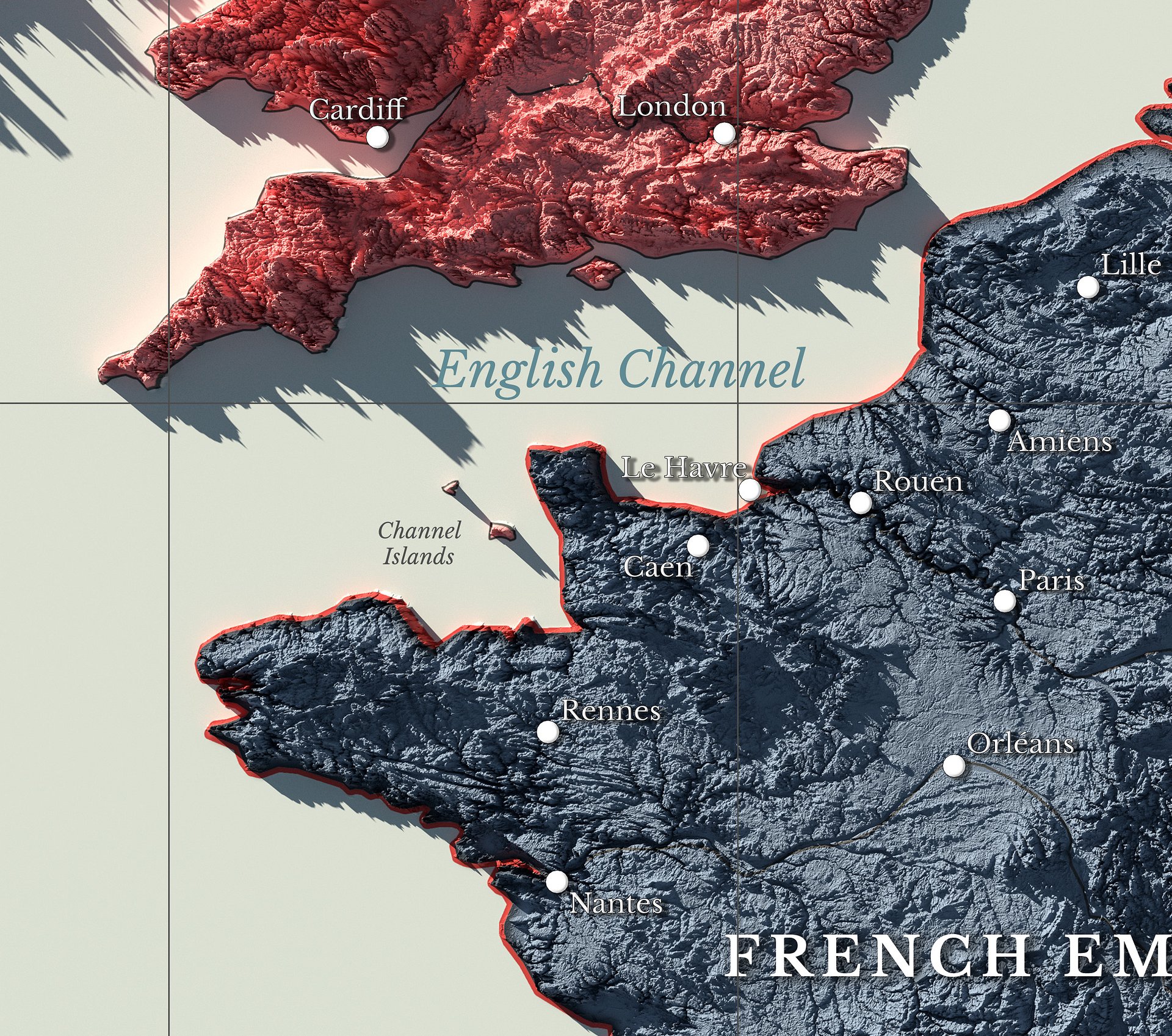
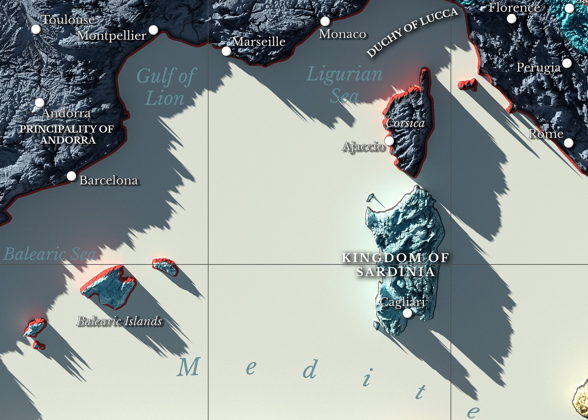
Napoleonic Europe - 1812 - Digital High Resolution Map
Napoleonic Europe 1812 Map
Ultra High Resolution Digital Download
13000×10000 px quality. Print poster size. Instant download.
Created through a detailed study of European borders, client states, alliances, and political conditions at the height of Napoleonic power in 1812.
The image shows Europe as it stood on the eve of Napoleon’s campaign against Russia.
What you get:
-
13k × 10k resolution file (most digital maps are only 2k to 4k)
-
Instant download after purchase
-
Perfect for classrooms, offices, gifts, or home décor
Who loves this:
History teachers, Napoleonic era enthusiasts, students, collectors, map lovers, reenactors, and anyone decorating with early 19th century European themes.
This map is excellent for decorative and educational use, but not intended as an academic reference.
This digital file is for personal use only. Commercial use is not permitted.